

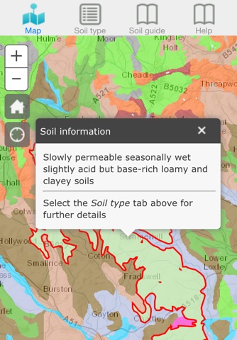
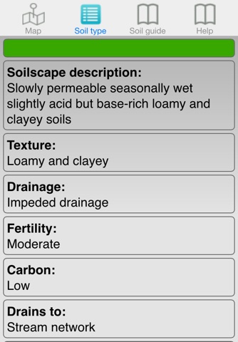
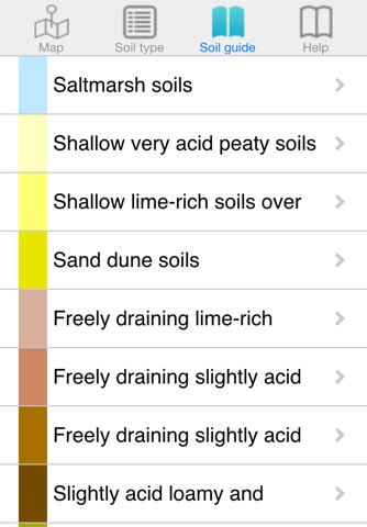

Soilscapes is an easy-to-use soil reporting tool which produces summary soils information for a specific location, based upon the “Soilscapes” soil thematic dataset.
Soilscapes is a 1:250,000 scale, simplified soils dataset covering England and Wales. It was created from the far more detailed National Soil Map (NATMAP Vector) held by NSRI (the National Soil Resources Institute) at Cranfield University, with the purpose of communicating effectively a general understanding of the variations which occur between soil types, and how soils affect the environment and landscape of the two countries. Soil exerts a strong influence on our whole ecosystem, being the foundation for many of the ecosystem services and functions recognised, and is a fragile resource that needs to be understood and protected.
Soilscapes is one of the most popular datasets available from NSRI - and to encourage a wider understanding of soils, access to this data is now made freely accessible. Soilscapes does away with confusing terminology, enabling informed decision-making by non-soil scientists who need to understand soil and how it affects broad landscapes. Using the Soilscapes app, it is simple to build up a good understanding of many fundamental soil-landscape processes for any region across England and Wales. The Soilscapes dataset is also available seperately to lease as one of the NSRI soil data products.